16
Feb

Staithes Changes

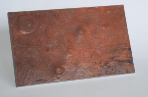
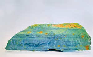
Finished two prints of a cliff face at Staithes, North Yorkshire. The first is one seen before, a colour-mapped scan showing areas of change:
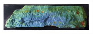
staithes-falsecolour

The second is a full colour print from a newer scanner:
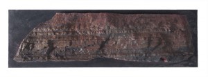
staithes-colourHere’s a shot of both, side by side (taken by Adam Clarkson) showing how the prints are aligned to allow direct comparison.
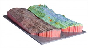
staithes-sidexside

The prints will be mounted on reinforced posters for presentation.
28
Jan

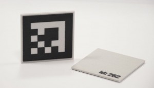
For Adam Clarkson‘s augmented reality project, we created AR markers as tiles:

dsc_0019

The marker system is from NyARToolkit and the 3D modeling was done in 3DS Max 2009.

28
Oct

Mars

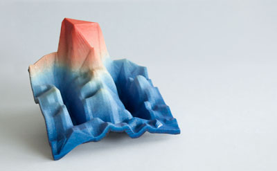
For the purposes of printing something for training on the Z650, a piece of the Martian surface, including Olympus Mons. This was produced with elevation and texture data from USGS Map-a-Planet Explorer service (www.mapaplanet.org).  The elevation data was taken from the MOLA digital terrain model map and processed in ParaView.
olympus mons

10
Sep

Staithes

3D print of a section of the cliff at Staithes, North Yorkshire, colour coded to show erosion since 2003. Black areas are ‘holes’ in the scan data.
staithes_800

Data supplied by Dr. Nick Rosser and Dr. Michael Lim at the Dept. of Geography, Durham University.

Model was trimmed, healed and thickened using Rapidform XOS2.

08
Sep

Laser Scan

High resolution laser scan of a brooch found at a Roman Building known as Sladwick, north of Shapwick in Somerset. This model is massively decimated to produce about 5k polys. Click and drag in the window to view the model:

This model was produced by scanning using a Leica laser scanner – 7 scans in all, 4 on the top side, 3 on the reverse. The main issue in scanning this object was the fact that the pin moved between scanning one side and the other. This meant dividing up the point cloud data to separate the pin from the main body.
More »

11
Jun

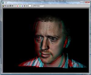
Ever wanted to create a red-blue 3D picture from a 3D scan? I did. Figured it out too. This post describes how you could get something like this:

agt5

Except, probably much better looking. I’m using the Mephisto 1.6 Complete software in conjunction with 3D Studio Max 2009.

Click more, for more…

More »

11
May

Here’s a workflow for printing 3d objects based on 3D point cloud visualisation data. It assumes access only to open source software and the Z-Print software that is shipped with a Z-Corp printer. In this example, the data represents a ground scan of an archaeological site. Here’s what you can end up with:

zp2

Click the ‘More’ link for the details.

More »

23
Apr

Rocks

Data, originally from Earth Sciences (?), supplied by Nick Holliman from the Interactive Media Technology Group, has finally been printed.  This took a bit of work to manipulate into a managable data-set ready for print. The original data is a LIDAR scan point cloud, originally given in VTK format. I had to write a tool to convert into point-cloud-only PLY.

mkville1

Apparently, its a cliff face near the sea in the US. Large expensive houses ride on the fate of coastline erosion.

05
Apr

Printing Data

Courtesy of Dr. Chris Gerrard in the Dept. of Archaeology, I got hold of some geophysics data. Using paraview, I was able to mesh the data, and thickened it using 3DS Max. The print was straightforward from there:

geophys1

Note that the colour information was added in paraview – by assigning a colour in the range blue to red depending on height, low to high.

26
Mar

Mephisto Scanner

The next piece of the replicator hardware setup is the Mephisto Scanner made by 4D Dynamics.  We currently have the Mephisto Complete scanner with Mephisto Turntable. More on our experiences of using this scanner later.